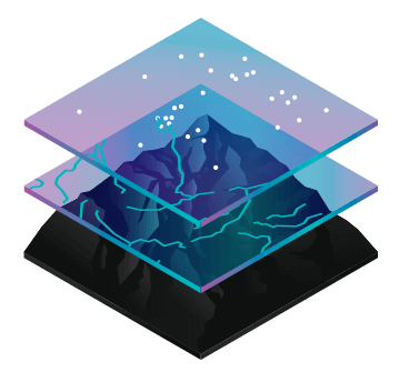
Geospatial Modeling
Our Geospatial Modeling service leverages advanced technologies to create detailed representations of geographic features and phenomena. Using cutting-edge tools and techniques, we develop accurate digital models that provide insights into terrain, environmental changes, and various spatial relationships. These models empower informed decision-making across industries such as urban planning, natural resource management, and disaster response.

Blue Economy
Dive into the future of sustainable economic growth with our Blue Economy solutions. We offer expertise in harnessing the potential of marine resources while preserving the health of oceans and coastal ecosystems. Our services encompass responsible aquaculture, marine renewable energy, coastal tourism planning, and more. Join us in building a thriving economy that values and protects our marine environment.
Spatial Planning
Efficient land use and development depend on well-structured Spatial Planning. Our experts combine geographical data, demographic insights, and stakeholder input to create comprehensive plans for urban and rural areas. By optimizing spatial organization and resource allocation, we help communities achieve balanced growth, improved infrastructure, and enhanced quality of life.
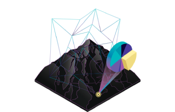
Remote Sensing & AI
Experience the synergy of Remote Sensing and Artificial Intelligence through our specialized service. We integrate data from satellites, drones, and other sources, and apply AI algorithms to extract valuable information. From monitoring environmental changes to agricultural yield prediction, our solutions offer real-time insights, enabling smarter decisions and resource management.
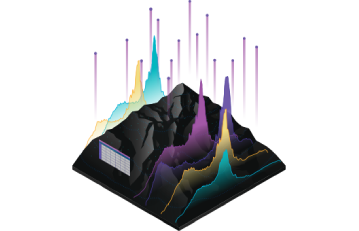
Decision Support Tools
Navigate complexity confidently with our Decision Support Tools. We develop customized software and platforms that assist businesses and organizations in making data-driven choices. By visualizing geospatial data, analyzing scenarios, and predicting outcomes, our tools empower you to strategize effectively, optimize operations, and respond adeptly to dynamic situations.
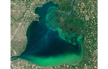
HABs
Protect aquatic ecosystems and public health with our Harmful Algal Blooms services. We employ advanced monitoring techniques to detect and predict the occurrence of HABs in bodies of water. By providing timely alerts and strategic recommendations, we help authorities and industries mitigate the impacts of these blooms, ensuring safe water supplies and thriving aquatic environments.
Geospatial Modeling
Our Geospatial Modeling service leverages advanced technologies to create detailed representations of geographic features and phenomena. Using cutting-edge tools and techniques, we develop accurate digital models that provide insights into terrain, environmental changes, and various spatial relationships. These models empower informed decision-making across industries such as urban planning, natural resource management, and disaster response.
Blue Economy
Dive into the future of sustainable economic growth with our Blue Economy solutions. We offer expertise in harnessing the potential of marine resources while preserving the health of oceans and coastal ecosystems. Our services encompass responsible aquaculture, marine renewable energy, coastal tourism planning, and more. Join us in building a thriving economy that values and protects our marine environment.
Spatial Planning
Efficient land use and development depend on well-structured Spatial Planning. Our experts combine geographical data, demographic insights, and stakeholder input to create comprehensive plans for urban and rural areas. By optimizing spatial organization and resource allocation, we help communities achieve balanced growth, improved infrastructure, and enhanced quality of life.
Remote Sensing & AI
Experience the synergy of Remote Sensing and Artificial Intelligence through our specialized service. We integrate data from satellites, drones, and other sources, and apply AI algorithms to extract valuable information. From monitoring environmental changes to agricultural yield prediction, our solutions offer real-time insights, enabling smarter decisions and resource management.
Decision Support Tools
Navigate complexity confidently with our Decision Support Tools. We develop customized software and platforms that assist businesses and organizations in making data-driven choices. By visualizing geospatial data, analyzing scenarios, and predicting outcomes, our tools empower you to strategize effectively, optimize operations, and respond adeptly to dynamic situations.
HABs
Protect aquatic ecosystems and public health with our Harmful Algal Blooms services. We employ advanced monitoring techniques to detect and predict the occurrence of HABs in bodies of water. By providing timely alerts and strategic recommendations, we help authorities and industries mitigate the impacts of these blooms, ensuring safe water supplies and thriving aquatic environments.